
Mapa topográfico Braunsbach
Mapa interativo
Clique no mapa para exibir a altitude.
Sobre este mapa
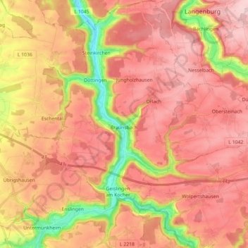
Nome: Mapa topográfico Braunsbach, altitude, relevo.
Altitude média: 397 m
Altitude mínima: 228 m
Altitude máxima: 499 m
Outros mapas topográficos
Clique em um mapa para visualizar sua topografia, sua altitude e seu relevo.
Mainhardt
Germany > Baden-Württemberg > Landkreis Schwäbisch Hall
Mainhardt, Landkreis Schwäbisch Hall, Baden-Württemberg, 74535, Germany
Altitude média: 455 m
Satteldorf
Germany > Baden-Württemberg > Landkreis Schwäbisch Hall
Satteldorf, Verwaltungsverband Crailsheim, Landkreis Schwäbisch Hall, Baden-Württemberg, 74589, Germany
Altitude média: 446 m