
Mapa topográfico Adams Lake
Mapa interativo
Clique no mapa para exibir a altitude.
Adams Lake
According to one account, the lake is 63 kilometres (39 mi) long and 1.6 to 3.2 kilometres (1.0 to 2.0 mi) wide. The surface elevation is 404 metres (1,325 ft) above sea level. The mean depth of 299 metres (981 ft) and maximum depth of 457 metres (1,499 ft) make the second deepest lake in BC (next to Quesnel Lake, which has a maximum depth of 511 metres (1,677 ft)) and 7th deepest lake in the world by mean depth. Another account gives a maximum depth of 397 metres (1,302 ft) and length of 72 kilometres (45 mi).
Sobre este mapa
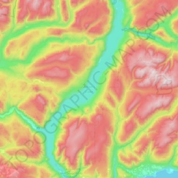
Nome: Mapa topográfico Adams Lake, altitude, relevo.
Altitude média: 1177 m
Altitude mínima: 346 m
Altitude máxima: 2289 m