
Mapa topográfico Wyoming
Mapa interativo
Clique no mapa para exibir a altitude.
Sobre este mapa
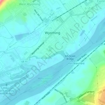
Nome: Mapa topográfico Wyoming, altitude, relevo.
Local: Wyoming, Luzerne County, Pennsylvania, United States (41.29455 -75.86141 41.31773 -75.82214)
Altitude média: 174 m
Altitude mínima: 159 m
Altitude máxima: 270 m
The flood of 2011 prompted the evacuation of the Wilkes-Barre Wyoming Valley Airport (in southern Wyoming). The planes were moved to a higher elevation to prevent flood damage; they were relocated to the Wyoming Monument.