
Mapa topográfico Lauricocha
Mapa interativo
Clique no mapa para exibir a altitude.
Sobre este mapa
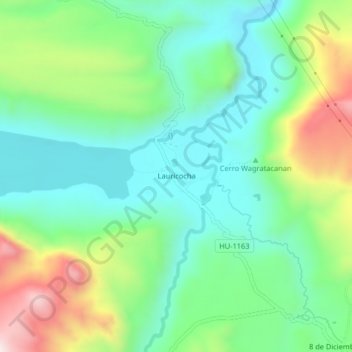
Nome: Mapa topográfico Lauricocha, altitude, relevo.
Altitude média: 4002 m
Altitude mínima: 3819 m
Altitude máxima: 4402 m
Lauricocha is located at 10°19′20″S 76°40′00″W / 10.32222°S 76.66667°W / -10.32222; -76.66667 on the shores of Lago Lauricocha in the Huánuco Region. The parish consists of half a dozen houses, scattered at an elevation of 3,850 m in a sparsely populated area near the village of Antacolpa, and 25 km northwest of Yanahuanca, the capital of the province of Daniel Alcides Carrión.