
Mapa topográfico Ferreries
Mapa interativo
Clique no mapa para exibir a altitude.
Ferreries
Ferreries is a municipality on the island of Menorca, in the Spanish autonomous community of the Balearic Islands. Its name is derived from the Catalan word ferrer ("blacksmith"), which in turn, comes from Latin word ferrum. At an elevation of 150 metres it is the island's highest town. Plaça Espanya
Sobre este mapa
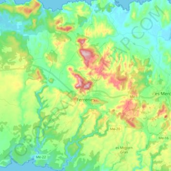
Nome: Mapa topográfico Ferreries, altitude, relevo.
Local: Ferreries, Menorca, Balearic Islands, 07750, Spain (39.92902 3.95743 40.05963 4.06378)
Altitude média: 82 m
Altitude mínima: 0 m
Altitude máxima: 268 m