
Mapa topográfico Kerhonkson
Mapa interativo
Clique no mapa para exibir a altitude.
Sobre este mapa
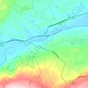
Nome: Mapa topográfico Kerhonkson, altitude, relevo.
Altitude média: 167 m
Altitude mínima: 70 m
Altitude máxima: 428 m
Outros mapas topográficos
Clique em um mapa para visualizar sua topografia, sua altitude e seu relevo.
Minnewaska State Park Preserve
United States > New York > Ulster County > Town of Wawarsing
Minnewaska State Park Preserve, Town of Wawarsing, Town of Shawangunk, Ulster County, New York, United States
Altitude média: 279 m
Village of Ellenville
United States > New York > Ulster County > Town of Wawarsing
Village of Ellenville, Town of Wawarsing, Ulster County, New York, United States
Altitude média: 325 m
Greenfield Park
United States > New York > Ulster County > Town of Wawarsing
Greenfield Park, Town of Wawarsing, Ulster County, New York, 12435, United States
Altitude média: 331 m