

Mapa topográfico Kumily
Clique no mapa para exibir a altitude.
Sobre este mapa

Nome: Mapa topográfico Kumily, altitude, relevo.
Local: Kumily, Peerumade, Idukki, Kerala, 685509, India (9.56680 77.12710 9.64680 77.20710)
Altitude média: 936 m
Altitude mínima: 454 m
Altitude máxima: 1231 m
Outros mapas topográficos
Clique em um mapa para visualizar sua topografia, sua altitude e seu relevo.

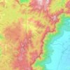
Periyar National Park Tiger Reserve
Periyar National Park lies in the middle of a mountainous area of the Cardamom Hills. In the north : The boundary commences from the point nearest to the Medaganam in the interstate boundary up to Vellimalai. and the east Thence the boundary follows the inter-state boundary from Vellimalai to Kallimalai Peak…
Altitude média: 929 m

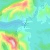

Periyar National Park & Tiger Reserve
Periyar National Park lies in the middle of a mountainous area of the Cardamom Hills. In the north, the boundary commences from the point nearest to the Medaganam in the interstate boundary up to Vellimalai. To the east the boundary follows the inter-state boundary from Vellimalai to Kallimalai Peak (1615 m)…
Altitude média: 929 m
