Mapa topográfico Bamber´s Green
Mapa interativo
Clique no mapa para exibir a altitude.
Sobre este mapa
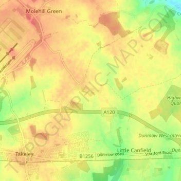
Nome: Mapa topográfico Bamber´s Green, altitude, relevo.
Altitude média: 98 m
Altitude mínima: 67 m
Altitude máxima: 116 m

Clique no mapa para exibir a altitude.
Nome: Mapa topográfico Bamber´s Green, altitude, relevo.
Altitude média: 98 m
Altitude mínima: 67 m
Altitude máxima: 116 m