
Mapa topográfico Güdesweiler
Mapa interativo
Clique no mapa para exibir a altitude.
Sobre este mapa
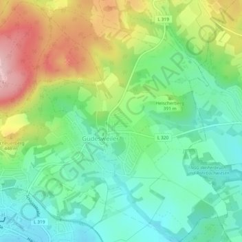
Nome: Mapa topográfico Güdesweiler, altitude, relevo.
Altitude média: 380 m
Altitude mínima: 304 m
Altitude máxima: 516 m
Outros mapas topográficos
Clique em um mapa para visualizar sua topografia, sua altitude e seu relevo.
Oberthal
Deutschland > Saarland > Oberthal
Oberthal, Landkreis St. Wendel, Saarland, 66649, Deutschland
Altitude média: 377 m
Momberg
Deutschland > Saarland > Oberthal
Momberg, Oberthal, Landkreis St. Wendel, Saarland, 66649, Deutschland
Altitude média: 410 m