
Mapa topográfico Parque Nacional Tingo María
Mapa interativo
Clique no mapa para exibir a altitude.
Sobre este mapa
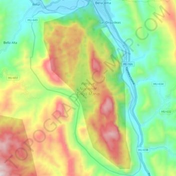
Nome: Mapa topográfico Parque Nacional Tingo María, altitude, relevo.
Altitude média: 1136 m
Altitude mínima: 645 m
Altitude máxima: 1906 m